


Voting District HTOP, Vance County, North Carolina
About
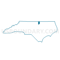
Outline

Summary
| Unique Area Identifier | 641565 |
| Name | Voting District HTOP |
| County | Vance County |
| State | North Carolina |
| Area (square miles) | 6.24 |
| Land Area (square miles) | 6.22 |
| Water Area (square miles) | 0.02 |
| % of Land Area | 99.73 |
| % of Water Area | 0.27 |
| Latitude of the Internal Point | 36.29847650 |
| Longtitude of the Internal Point | -78.43595320 |
Maps


Graphs
Select a template below for downloading or customizing gragh for Voting District HTOP, Vance County, North Carolina


Neighbors
Neighoring Voting District (by Name) Neighboring Voting District on the Map
- Voting District KITT, Vance County, NC
- Voting District SH1, Vance County, NC
- Voting District SH2, Vance County, NC
- Voting District WATK, Vance County, NC
- Voting District WH1, Vance County, NC
- Voting District WH2, Vance County, NC
Top 10 Neighboring County Subdivision (by Population) Neighboring County Subdivision on the Map
- Henderson township, Vance County, NC (21,046)
- Kittrell township, Vance County, NC (5,822)
- Watkins township, Vance County, NC (640)
Top 10 Neighboring Place (by Population) Neighboring Place on the Map
Top 10 Neighboring Unified School District (by Population) Neighboring Unified School District on the Map
Top 10 Neighboring State Legislative District Lower Chamber (by Population) Neighboring State Legislative District Lower Chamber on the Map
Top 10 Neighboring State Legislative District Upper Chamber (by Population) Neighboring State Legislative District Upper Chamber on the Map
Top 10 Neighboring 111th Congressional District (by Population) Neighboring 111th Congressional District on the Map
Top 10 Neighboring Census Tract (by Population) Neighboring Census Tract on the Map
- Census Tract 9610, Vance County, NC (6,315)
- Census Tract 9603, Vance County, NC (5,151)
- Census Tract 9604, Vance County, NC (3,960)
- Census Tract 9608, Vance County, NC (2,306)